Alaska Coastal Bluff Erosion Mortgage
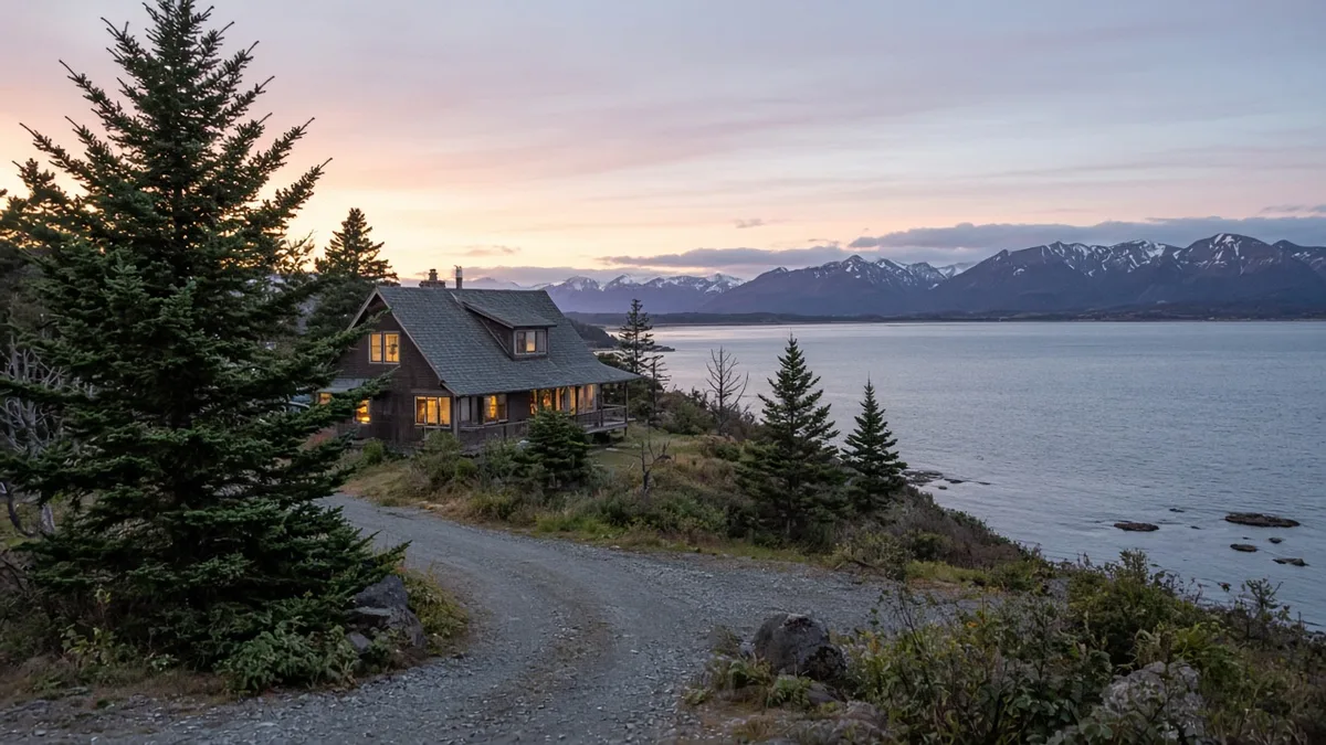
An Alaska coastal bluff erosion mortgage file is a house loan where the dwelling sits inside an area a public map marks for bluff retreat or coastal erosion. The view is not the collateral. The ground under the house is, and so is the yard the house still needs. Buyers looking at bluff property in Homer meet this when a listing sells Kachemak Bay and the appraisal later has to say whether the parcel falls inside a mapped hazard.
This is not the remaining economic life article. That page is about the years an appraiser assigns to the improvements. It is also not flood insurance. A FEMA flood map and a bluff-retreat map answer different questions. A house can sit outside a special flood hazard area and still stand on a mapped eroding edge. Alaska Home HQ is educational. It is not a lender, a geologist, or a planning department. Rates vary. Subject to credit approval.
What an Alaska coastal bluff erosion mortgage map is
The City of Homer posts the state’s coastal bluff work on its coastal bluff information page. The Alaska Division of Geological & Geophysical Surveys prepared the assessment. The city page hosts the report and the map sheets for shoreline change from 1951 to 2019 and for coastal bluff stability. The state data-set page for that work is the DGGS metadata record. Those sheets are Homer’s maps. They are not a statewide setback. This page will not hand you a retreat rate or a setback distance to paste onto a different shore.
If the house is in another town, use that town’s map, and link the page that publishes it. A Kenai bluff, a Kodiak beach, and a Seward waterfront are not Homer’s shoreline-change sheet. A screenshot in a text thread is not the map of record. If nobody has published a map for that stretch of coast, say so. Borrowing Homer’s lines and calling them local is how a file invents a boundary an agency did not draw.
A mapped retreat or instability area means a public agency has already flagged the edge. It does not, by itself, mean the house is unlendable. Financed houses stand on coastal ground all over Alaska. The file has to show where the improvements sit relative to the mapped area, and what an appraiser can say about marketability once that location is known. “Somewhere near the bluff” is not a location.
Where the house sits
Ask for a survey or an as-built that shows the dwelling, the deck, the well, and the top of the bluff as they exist on the ground. The home appraisal process is where the appraiser comments on outside conditions that affect value. A listing photo is not a measurement. The map is not a survey. You want both, and you want them to agree about which side of the mapped area the foundation occupies.
Rates of retreat and setback distances, when a study or an ordinance states them, live on that study or that ordinance for that specific shore. They change when the study is updated. This article will not supply a feet-per-year figure or a foot-count to measure from the edge. Carrying one town’s line onto another town’s bluff is how a file gets a confident wrong number.
Spring is a different coast than August. Freeze-thaw, groundwater seeping out of a layered bluff, and a fall storm at high water can move a face between the day you write the offer and the day the appraiser walks it. If the seller’s disclosure mentions a slide, a lost beach stair, or a deck that used to sit farther from the edge, that history belongs next to the map. The seller disclosure guide covers what Alaska sellers are asked to report. Read the earth-movement questions before you waive the inspection period.
Walk the top when it is safe. Look for a fresh scarp, a leaning spruce, a sagging stair, and a tank or a well that sits closer to the drop than the house does. Wastewater on a moving edge is a siting question for the Department of Environmental Conservation and a condition question for the appraiser. It is not a reason to skip the map. A well that was legal when it was drilled can become the problem if the edge walks toward it. The survey date matters as much as the drill date.
What investors read, separate from a flood policy
Fannie Mae’s site section of the appraisal report says that investor will not buy a loan on a property subject to certain land-use rules, including some coastal rules, when those rules create setback lines or other limits that prevent reconstruction or maintenance of the improvements if they are damaged. The point is whether the house can be repaired or rebuilt, not whether the view is good. A bluff house with no such limit is a different file from a house whose local rule blocks putting the structure back if the edge takes it.
That is one investor’s rule for loans that investor buys. It is not a sentence that every bluff house fails. Ask the lender which program is on the table, and hand that underwriter the map and the local shore rule rather than a summary from the listing. A paraphrase of a setback is how the wrong distance enters the file. If you name a setback, name the ordinance section you opened. This page is not that ordinance.
Flood coverage follows a FEMA zone. Bluff retreat follows a geology map. Order the flood determination anyway, because a coastal lot can carry both labels, and then keep the two papers in two piles. Paying for flood insurance does not answer the bluff question. Skipping flood insurance because the house is “on a hill” does not answer it either, if part of the lot is still in a mapped flood area. Two maps, two answers.
The title insurance guide explains Schedule B. An easement for a path along the edge, a recorded shore restriction, or a deed limit on shoreline hardening belongs in that schedule when it is of record. Title insures what is recorded. It does not insure that the bluff will stay where it was on the day of the survey. A title policy is not a geology report, and a geology report is not a loan approval.
A geotechnical letter, if the seller already has one, is useful because it talks about this slope rather than a regional story. This page will not pretend every lender orders one. If the mapped area covers the house and the only document in the file is the listing photo, the appraisal comments will be thin. Thin comments are how a condition shows up in the last week, after the rate lock is already counting down.
How to shop the edge
Ask which map sheet the parcel falls on, and ask for the date of that sheet. A hazard note from an old printout may not be the sheet the city posts now. Homer’s page is explicit that DGGS produced the report, the maps, and the GIS layers. Use the page, not a retelling of it. If the house is outside Homer, do the same thing with whatever agency mapped that coast. Naming a map without the page is how the wrong shoreline gets into the commitment.
Package the file in a short stack:
- The published map sheet, with its date, showing the parcel.
- A survey or as-built locating the house, deck, and the top of the bluff.
- The appraisal comments on location and marketability.
- Any recorded shore restriction in Schedule B.
- Any geotechnical letter the seller already has.
A Permanent Fund Dividend can help with cash to close or with a repair you have already agreed to fund. The 2026 dividend is $1,200, including a $200 energy relief payment, according to the Permanent Fund Dividend Division. It does not move a bluff line, and it does not insure the ground.
Alaska Housing Finance Corporation programs are educational. Premier Mortgage (NMLS# 1168048) does not offer AHFC loans. Any program you use still has to accept the ground the house stands on.
If the map, the survey, and the appraisal tell the same story, the rest of the loan is an ordinary file. If they disagree about whether the house is inside the mapped area, reconcile them before you waive title and inspection deadlines.
Ready to explore your options? Get a free home loan quote from Premier Mortgage (NMLS# 1168048).
Frequently Asked Questions
Is a coastal bluff map the same as a flood zone?
A flood zone is not a bluff map. FEMA’s map drives the flood-insurance question, and a geology sheet asks whether the edge under or beside the house is retreating. A lot can sit outside a special flood hazard area and still fall inside a mapped bluff area. Keep both determinations in the file.
Does a mapped erosion area mean the lender declines the loan?
Not by itself. Lenders and the investors who buy loans read where the improvements sit, how the market treats that location, and any land-use rule that would block repair or rebuilding after damage. Many coastal houses are financed, and a mapped area with no survey is an incomplete file rather than an automatic decline. Subject to credit approval and to the property qualifying.
Can I use Homer’s bluff maps for a house in another town?
Only for a house on the coast those sheets cover. The City of Homer page hosts DGGS maps for Homer, including shoreline change from 1951 to 2019 and a bluff-stability sheet. Another town needs its own published map, and the link belongs in the file next to the sheet. Pasting Homer’s line onto a different beach invents a boundary the agency did not draw.
What if the house is outside the mapped area and the yard is inside it?
The file still has a location problem, because the yard, the stair, the well, or the drainfield may be the part at risk. The survey shows which improvements fall inside the mapped area. An appraiser can comment on marketability when the usable ground is what the map flags, even if the foundation sits farther inland. Measure that on the survey rather than writing a guessed distance into the offer.
Who updates the map if the bluff moves after closing?
The agency that published the map updates it on that agency’s schedule, not on your closing date. A survey is a snapshot of the day it was drawn, and later movement is a property condition for you, your hazard policy, and any local shore rule. Title insurance does not promise the edge will stay put. Keep a copy of the sheet you relied on when you removed contingencies.
Ready to Take the Next Step?
Get a free home loan quote today through our trusted partner.
Or call 9078411600
Disclaimer: This article is for informational purposes only and does not constitute financial, mortgage, legal, or tax advice. Interest rates, loan programs, eligibility requirements, and fees are subject to change without notice and may vary based on your individual circumstances. Alaska Home HQ is not a lender, broker, or financial institution. All loan applications are processed by Premier Mortgage (NMLS: 1168048). We may have a business relationship with Premier Mortgage and may receive compensation when you use their services through our links. Consult a licensed mortgage professional before making financial decisions. Terms of Service · Privacy Policy